
Environmental hazmat and facility information at your fingertips.
state and federal data – 100% free to view
*if you get a message saying you are already subscribed, follow the update preferences link above for access or send us an email. customerservice@banksinfo.com
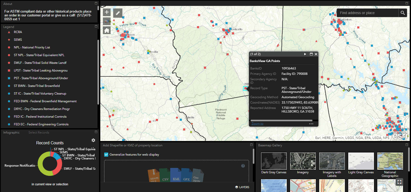
Banks HazView is a full-featured mapping application for environmental professionals, engineers and researchers. Users can quickly zoom to areas of interest to review basic information on commercial facilities and potential environmental hazards. This includes chemical processing and storage facilities, brownfields, Superfund sites, chemical spills, and leaking tanks. Banks has pulled information directly from our environmental records database and made it available to the public free of charge (email submission required for access).
Please Note: Banks HazView is not intended to be ASTM E1527-13 compliant and is not a replacement for a Phase I ESA database report. Please see the ASTM E1527-13 compliance tab below for more information.
Banks HazView contains data exported directly from our ASTM E1527-13 database. Both state and federal datasets are provided. This includes, but is not limited to: Petroleum Storage Tanks (PST), Leaking Underground Tanks (LPST), Superfund sites, National Priority List (NPL), Solid Waste Facilities (SW), and Brownfields (BWN).
While the data is pulled directly from our ASTM E1527-13 database, Banks HazView is not a replacement for our Regulatory Database Report and is not ASTM compliant.
Some government records are not readily mapable due to incomplete or inaccurate address and facility information from the reporting government agencies and require additional research to identify. Ummapped records do not appear within BanksView or within any of the associated data presented. Some datasets within the viewer may be older than 90 days. BanksView is not intended to replace the Banks Regulatory Database Report and should not be used for a Phase I site assessment or any other commercial / non-commercial pursuits or decision making. It is possible that inaccuracies in any of the data presented within Banks HazView can be traced back to the Agency that originally sourced the data. The Banks Group and Banks Environmental Data will not be held liable for any information obtained within the Banks HazView applications.
California, Colorado, Georgia, Illinois, Pennsylvania
The HazView application is currently in development. We intend to add more states to the coverage area within the Banks HazView application. Your feedback during this time will help us make this application even better.