
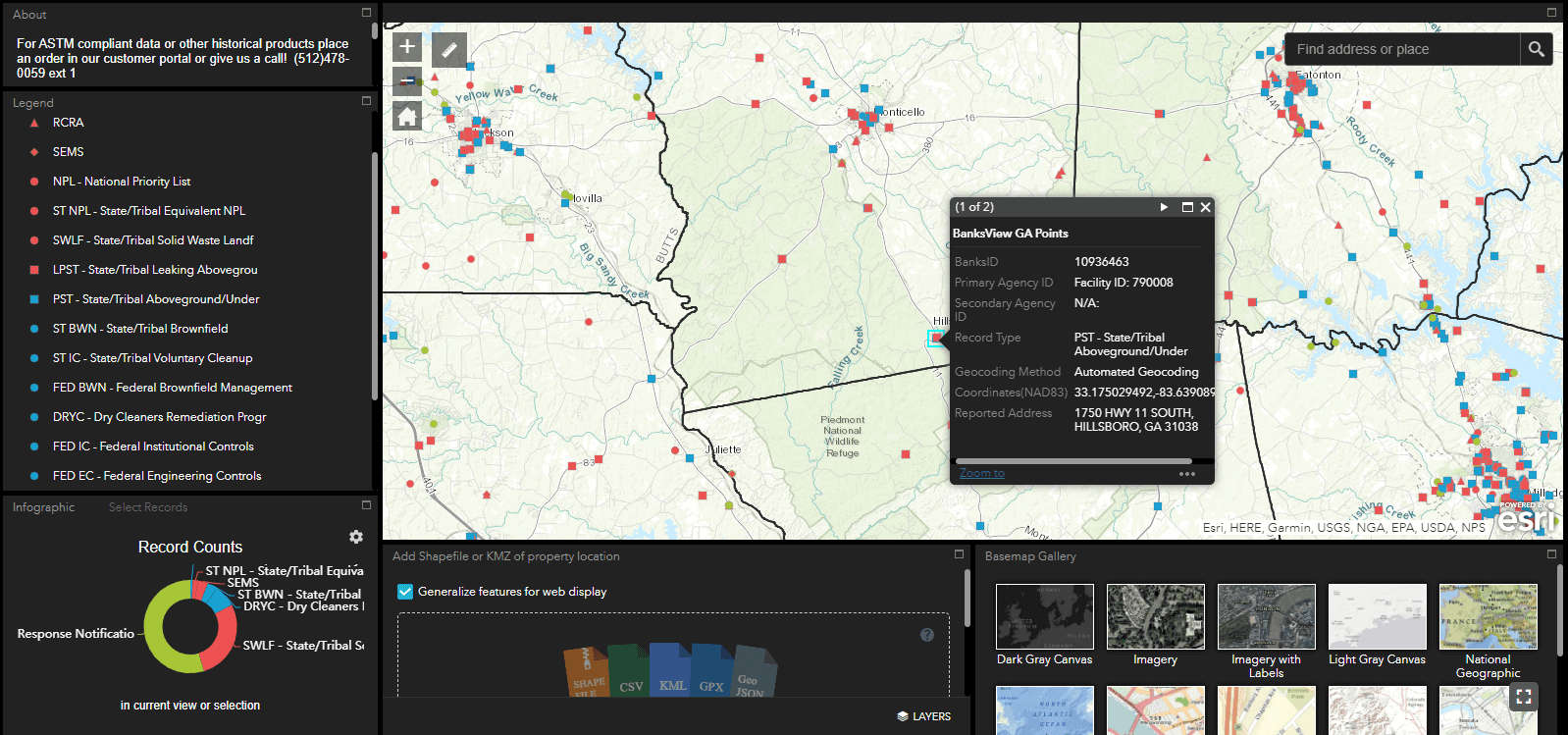
Banks HazView is an innovative, full-featured GIS map application created by the Banks team to bring Phase I ESA style data right to your fingertips. We are excited to offer this new service free of charge for registrants.
Created with environmental professionals, researchers and interested novices in mind; HazView allows users to view basic information about commercial facilities and potential environmental hazards in any given coverage area. HazView datasets include:
- EPA Superfund Program
- RCRA Records
- State/federal Brownfields
- Leaking Petroleum Storage Tanks
- Above and Underground Petroleum Storage Tanks
- Dry Cleaners
- Emergency Response Notification System (ERNS)
- And others
Pulled directly from the same robust environmental records database used in our Phase I Regulatory Database Reports, the color-coded data points reflect occurrences from state, federal and tribal datasets that have already been geocoded. Banks HazView is not intended to be ASTM E1527-13 compliant. To access the fully compliant data, please call us at (512) 478-0059 or email banks@banksinfo.com to request a Regulatory Database Report.
Banks is starting the initial launch of Banks HazView with California, Colorado, Georgia, Illinois, and Pennsylvania – with more states to quickly follow. Take it for a spin and let us know what you think!