
In previous installments of our Understanding Aerial Photography blog series, we covered the History of Aerial Photography and Scaling and Formatting of Aerial Imagery. In this post, we will explore the different types of formats in which aerial imagery can be viewed. Aerial photography can be displayed in several different formats. The most basic format of aerial photography is hard-copy prints derived from the original negative. In today’s industry, these prints are scanned and converted into digital image files (jpg, tif, etc.). Imagery in digital formats can be viewed using any type of image viewer, manipulated using various photo editing tools, and easily loaded into GIS software to create custom maps, overlay boundaries, or to examine specific areas of interest. PDFs are also a very common digital format of aerial photos because they do not require special software to view and can be easily inserted into reports.
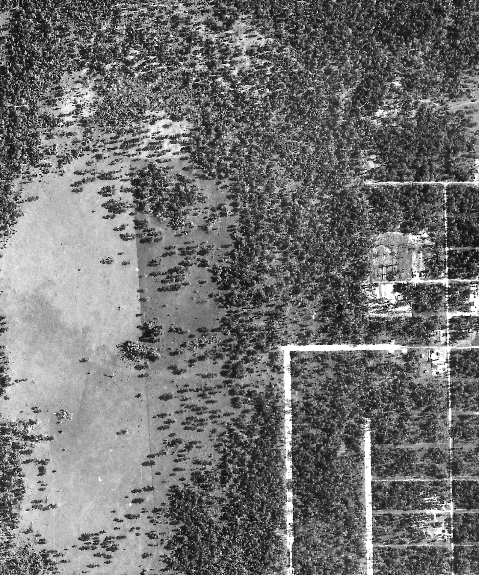
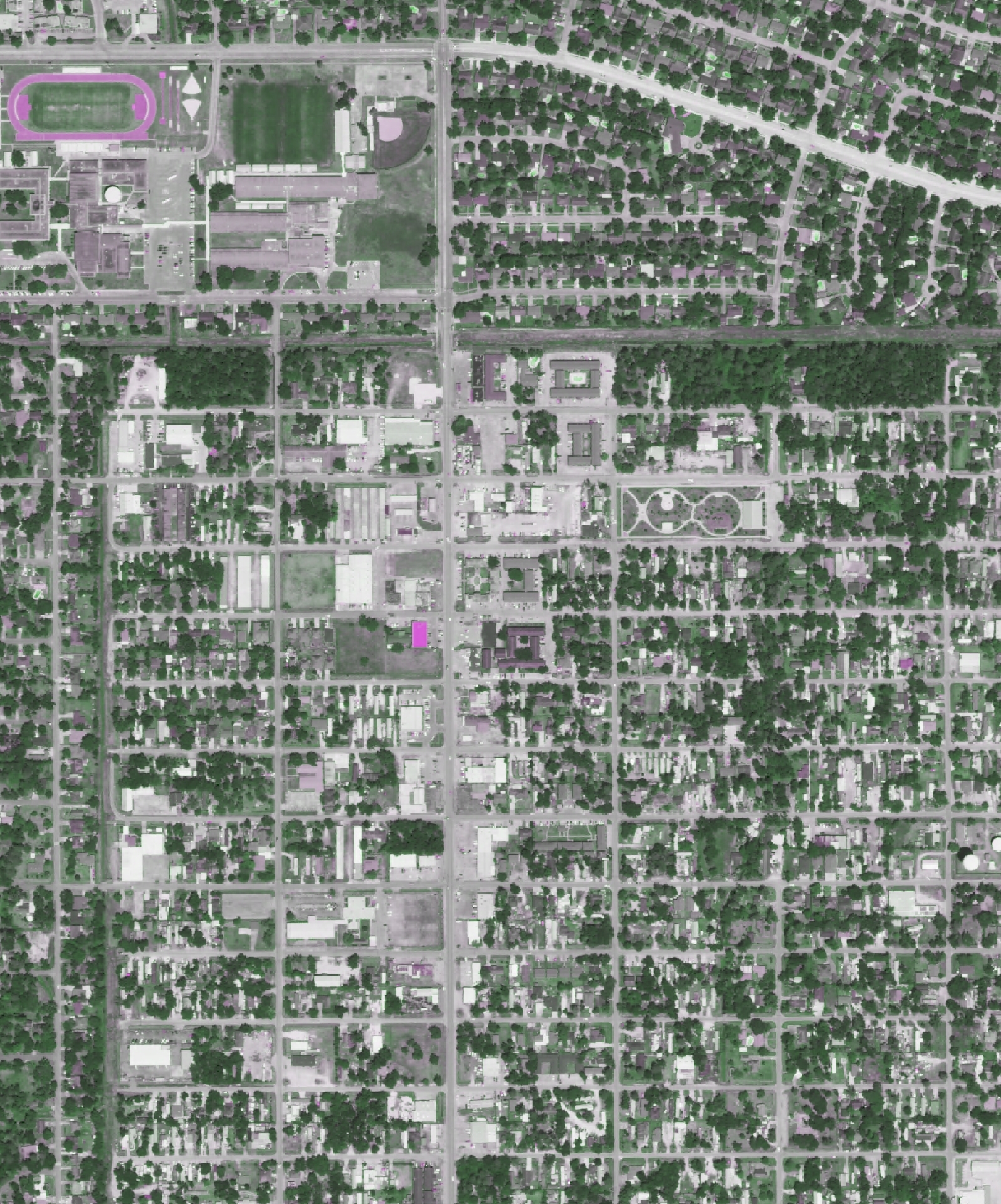
In the past, aerial imagery could be viewed in stereo pairs (overlapped images). Using specially made glasses, images viewed as stereo pairs added an elevation dimension to otherwise flat images. Now many GIS software programs include technology that can add a third dimension to photos. Shown below left is a historical aerial photograph taken in 1944 that was captured from an aircraft and printed on photographic paper. The image has since been digitally scanned, saved as a jpg file, and geo-referenced using GIS. The aerial photo on the right was taken in 2010 and was digitally captured from a satellite. Although the images were collected using two different technologies, both provide sufficient resolution and clarity to make geographic features easily identifiable and provide a depiction of land changes over time.
With the emergence and application of GIS technology in nearly all industries, professionals who analyze aerial photography generally prefer digital image files with geographic references. This geo-referencing adds a spatial aspect to a 2-D image, which allows users to view frames precisely where they are geographically located. This is accomplished by adding “control points” to the image that correspond to a certain coordinate or location on a base map. The historical aerial photo shown below illustrates how the two images appear seamless. Using numerous control points, shown here as red crosshairs, an older image can be geo-referenced on top of a more recent aerial.
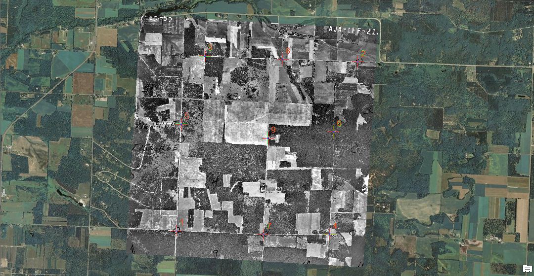
Two aerial photos with geo-referencing
Geo-referenced frames also allow users to examine large areas at closer scales and are ideal for long linear sites. Most geo-referenced files include the image file, a world file, and a projection file. When the image file is inserted into a GIS program such as ArcGIS, a pyramid file can also be created. This allows the image to refresh more quickly when the viewing window is adjusted. Hopefully, this post has provided you with basic knowledge of aerial imagery formats. Feel free to contact us if you have any questions regarding this topic or any other topic regarding aerial imagery.
 Until next time,
Adam Marshall
Program Manager – Aerials & Historic Mapping
amarshall@banksinfo.com