
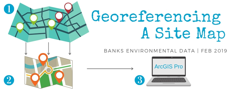
There are endless tips and tricks you can learn when using GIS software to increase efficiency and simplify your workflow – use the walkthrough below to learn how to georeference a site map (or other image files) using ArcGIS Pro.
What is Georeferencing?
Georeferencing is the process of assigning GPS coordinates to digital image files (or raster data) so that you can line up one map directly on top of another.
For example, imagine trying to compare a historical aerial photograph of your hometown to a modern-day satellite image from Google Maps. To compare the two images, you would likely start by looking for familiar landmarks contained within both pictures such as buildings, streets, or rivers. Once you have found your bearings (also known as control points), you will be able to place the photograph on top of the satellite image and compare the two.
Vocabulary:
Control Points – they tell the GIS software that a landmark in the scanned image is the same landmark in the other image. Control points help us accurately place one image on top of another so that all streets, buildings, and other features line up correctly.
Raster Data – in this case, the raster data is our image file. They are typically in .jpg, .tif, .png file formats. Examples are satellite images, scanned historical maps, and site maps for commercial projects.
Basemap – a readily available background map that can be added into a GIS via an online web service. ESRI offers many different types of basemaps: satellite imagery, topographic maps, etc.
How to georeference a site map in ArcGIS Pro:
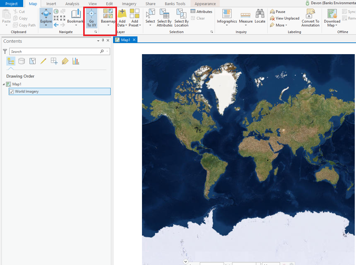
1. Turn on a basemap and locate your site.
If you have GPS coordinates, use the locate XY tool to zoom to that location. If not, try zooming in and out on the aerial imagery basemap to find a geographic landmark you recognize (a city, specific roads and intersections, lakes or other bodies of water) until you find your site.
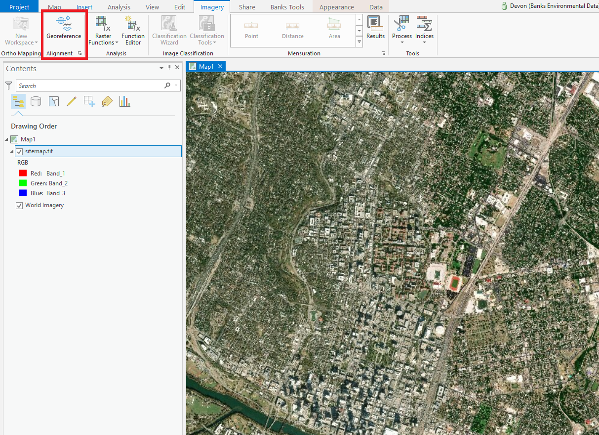
2. Once you’ve found the general location of your site, you’ll need to insert your site map file into ArcGIS Pro (for georeferencing site maps, we have found that TIFF or JPEG files work best). You can do this either by dragging and dropping the file directly into the program, or by going through the Map tab and clicking ‘Add Data’ → ‘Data’ to search for your site map in your file directory.
NOTE: To georeference a PDF file you will first have to convert it to tiff or jpg formats
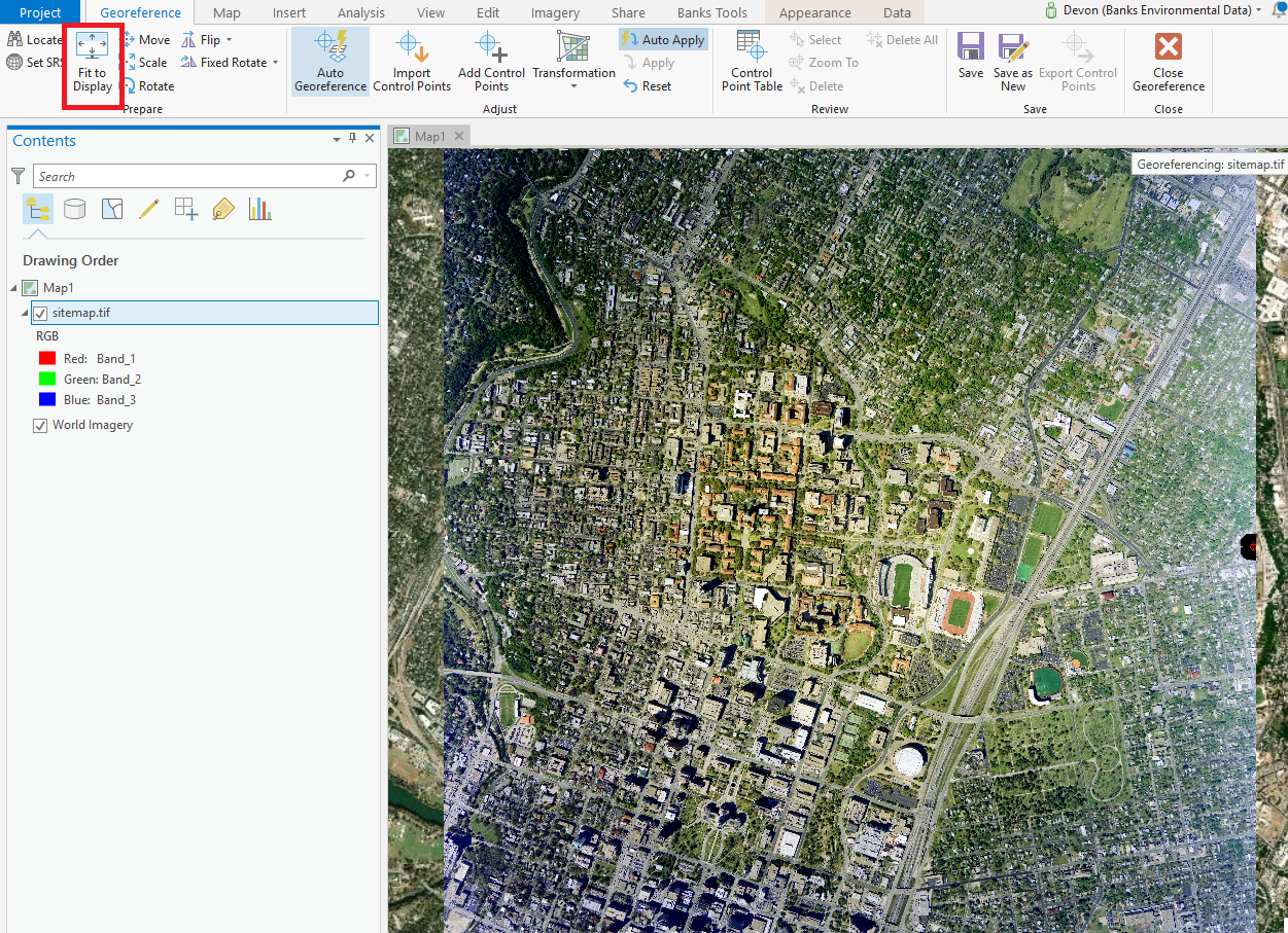
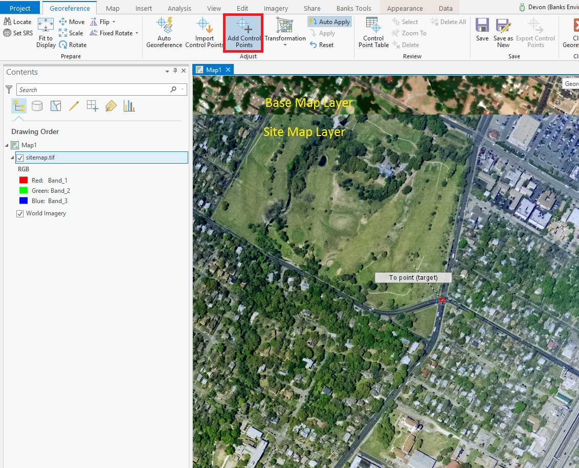
3. Make sure the layer you want to georeference is selected, open your Imagery tab, and click on Georeference. Then click the Fit to Display button to make your site map file visible. Make sure that it’s at the top of your Table of Contents, otherwise it will appear “behind” your basemap.
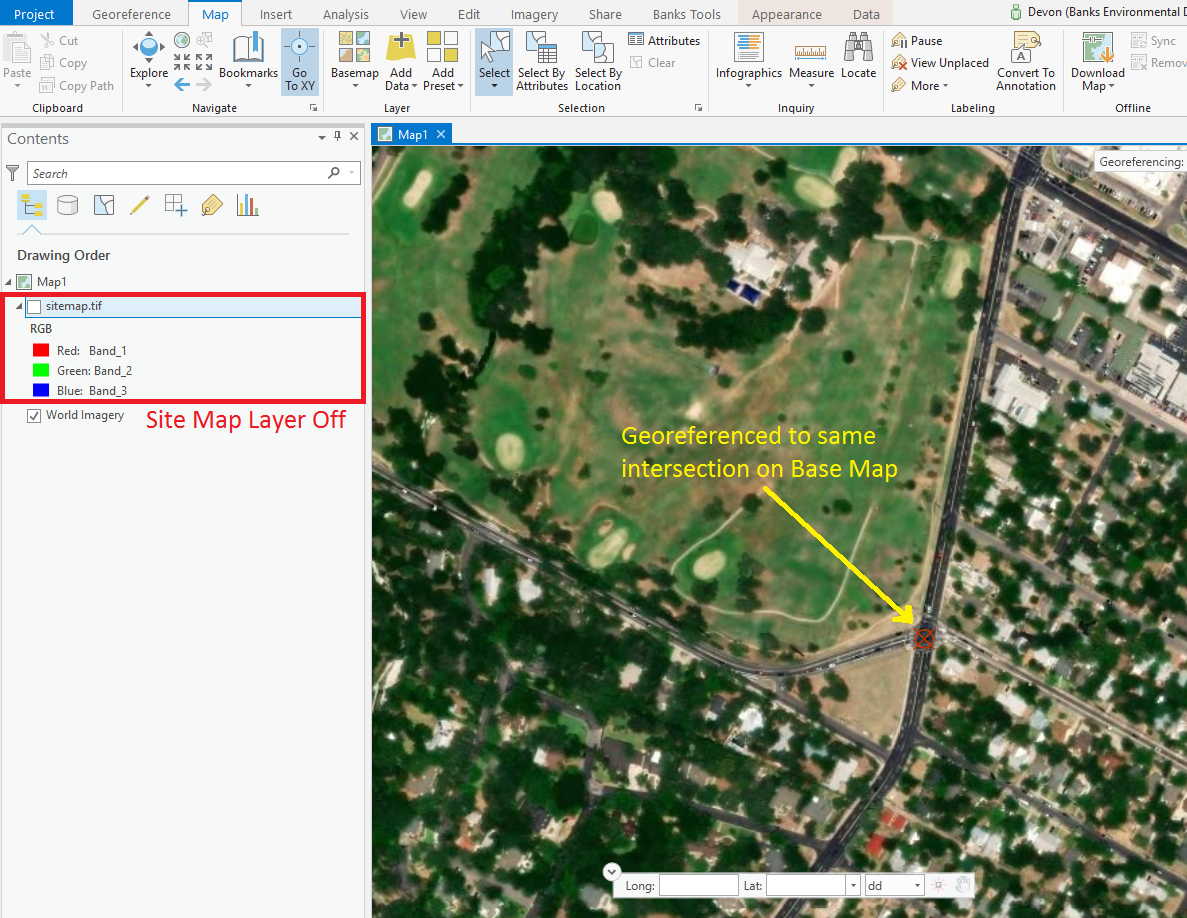
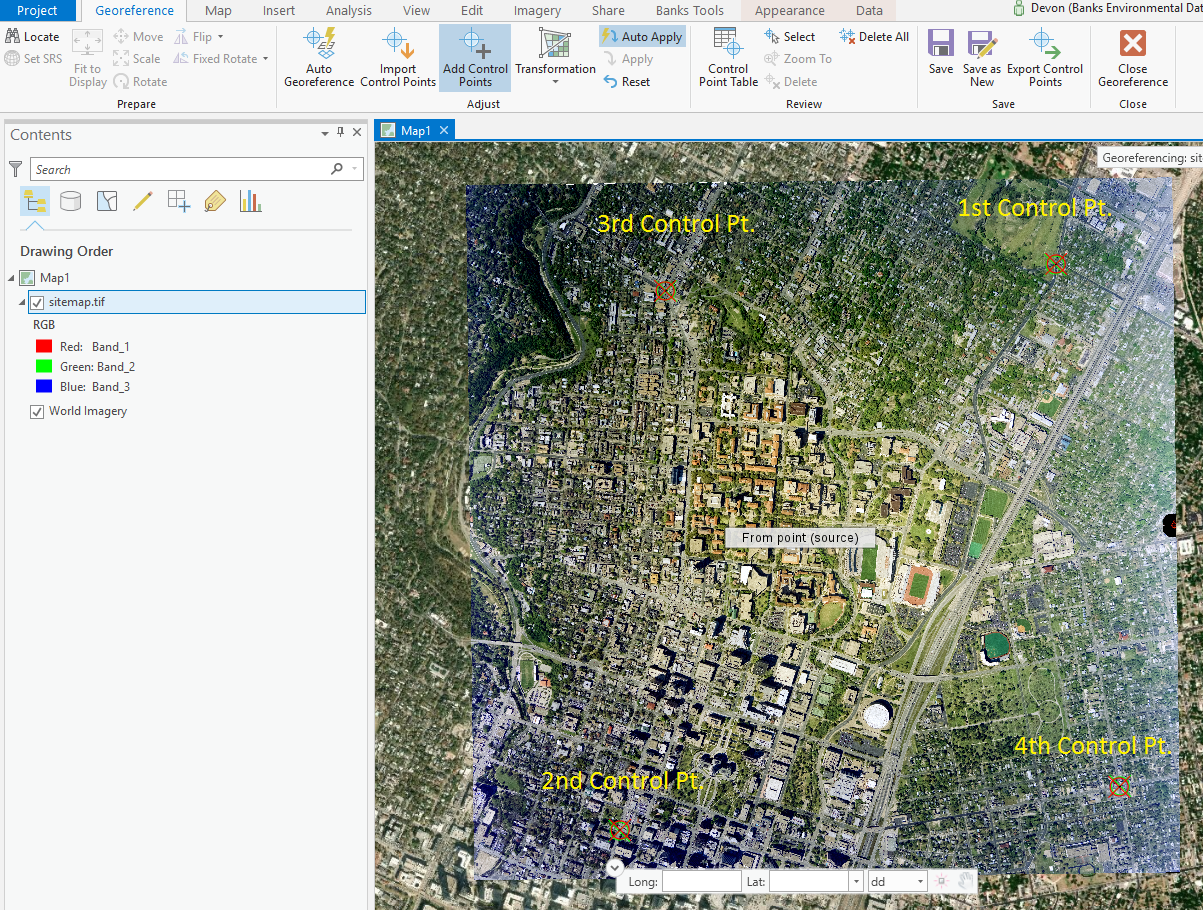
4. Start at one of the corners of your site map file and find your bearings, and then place a control point. Your cursor will now have a line connected to it. Toggle your site map file off, and then click on the same area on your basemap to finish the first control point.
5. Next, shift to the diagonal corner (for instance, if you started in the top left-hand corner, you’d shift to the bottom right-hand corner). Repeat step 4: place a point on your site map, and then place the finishing point on the basemap in the same area.

6. Now shift to an adjacent corner. Repeat the same steps and place your third point, first on the site map and then on the basemap.
7. The fourth point will go on the final corner, which should be located diagonally from your third corner. Repeat the same steps. You can add more points if you would like (generally six is a good number of points for georeferencing), but four points should suffice for general site map georeferencing. If you add more points, we suggest that they are spaced out, as placing control points close together can skew your image.
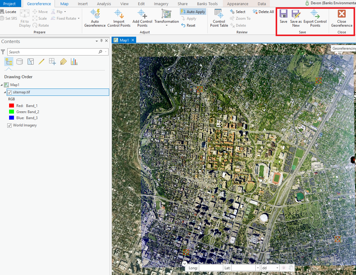
8. After all your control points have been placed, open the Imagery tab again and click ‘Save’ → ‘Close Georeferencing’. This will save your control points and allow anyone to view this site map file in a GIS. Make sure to send any and all associated files that have been created during this process.
You can find more information on georeferencing and raster data here:
Aaron Pearce
apearce@banksinfo.com