
Last month President Obama signed into law the Biggert-Waters Flood Insurance Reform Act of 2012. The new bill reauthorizes the Federal Emergency Management Agency’s (FEMA) National Flood Insurance Program (NFIP) through September 2017, and outlines modifications to the program that serve to improve overall efficiency and effectiveness.
According to an article published by the National Association of Realtors, “The NFIP had been operating under stopgap extensions (18 since 2008) and shut down twice for several weeks. Just one of these lapses, in June 2010, stalled more than 40,000 homes sales or 1,300 homes per day.” Extending the program five more years ensures coverage to the 21,000 communities that depend on flood insurance in order to receive mortgage funding and protects future real estate transactions from disruption.
Changes in the program include:
- Phasing out subsidies for many properties
- Raising the cap on annual premium increases
- Allowing multifamily properties to purchase policies
- Imposing minimal deductibles for flood claims
- Requiring debt repayment plan for previous flood seasons
- Establishing a technical mapping advisory council to lead FIRM modernization
The new legislation also responds to the nearly $18 billion worth of funds borrowed from the U.S. Treasury to assist those affected by the 2005 hurricane season. To offset the deficit, the Biggert-Waters Act requires the NFIP to raise $3 billion to reduce the treasury loans. Much of the savings will be realized through eliminating subsidized insurance rates for properties with repeated flood claims.
The NAR states, “This is a major victory for the 5.6 million home and business owners who rely on the NFIP, taxpayers across the country who will spend less on federal disaster assistance.” This act serves as a safe guard for many Americans who cannot rely on private insurance companies to protect their homes from incidents of flooding. Not only primary homes have coverage under the NFIP, but also secondary and vacation homes as well.
So what does the revised flood insurance law mean for the Phase I ESA industry?
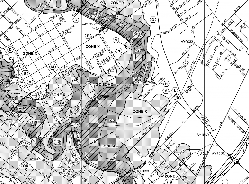
Be on the lookout for new and updated Flood Insurance Rate Maps (FIRMs) to reflect changes in flood prone areas, areas of concern, and unmapped communities. Hopefully the maps will provide greater detail in flood prone areas in order to allow lenders, as well as EPs, to accurately assess a site’s vulnerability to risk. If you are an EP conducting ESA investigations in areas of high flood risk, be aware that flood zones are being reevaluated. Based off of the NFIP’s determinations, your site could soon be zoned differently and considered to be a higher risk property.
FIRMs, in conjunction with current and historical topographic maps, can be highly useful for EPs attempting to determine environmental risks for commercial properties. FIRMs show flood zone boundaries which indicate susceptibility to flooding, while topographic maps use contour lines to display changes in elevation. Analysis of these two maps can aid an EP in determining a property’s susceptibility to contamination from nearby sites by better understanding local geographic features.
To find out more information about the National Flood Insurance Program please visit the NFIP website.
Banks provides water well database logs for all US states and territories.