
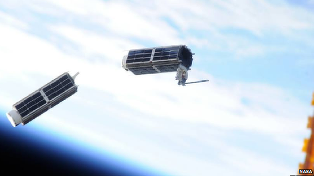
A Silcon Valley startup called Planet Labs has designed small satellites, known as cubesats, that are the size of shoe boxes and cost just thousands of dollars to produce (as opposed to conventional satellites that can require hundreds of millions). Planet Labs intends to launch 131 satellites in the next 12 months, making it the largest network of satellites on Earth.
This robust network of satellites will be able to capture high quality aerial imagery on a daily basis, worldwide. According to an article written by the BBC, “In February the first few in its initial batch of 28 were ejected out of an airlock on the International Space Station. These cubesats – called ‘doves’ in line with their peace-harboring ambitions – are now sending back their first images from low-Earth polar orbit, passing over Earth at five miles a second. The pictures are detailed enough to pick out individual trees (although not individuals, addressing objections from privacy advocates) – which will give unparalleled insight into activity on the planet’s surface.”
How will this affect the way you conduct Phase I ESAs?
Watch the video below to help identify the countless industries this service could benefit, and begin thinking about how you can use this data resource to supplement your ESA site visits.
Interested in this topic? Read our related post, “Personal drones: The latest data resource for Phase I ESAs?”
Jordan Schmidt 
Editor
jschmidt@banksinfo.com