
 In honor of a holiday best known for turkey, stuffing and mashed potatoes we decided to bring a bit of history to the table.
The first Thanksgiving was in 1621 – almost four centuries ago. During this time, explorers were actively discovering the Americas and cartographers were busy hand drawing maps from the explorer’s notes. These maps had some serious flaws. For example, they showed California as an island floating in the Pacific and depicted the great lakes as a large river. Despite these and other incorrect assumptions, the early maps were surprisingly detailed and helped facilitate further European settlement.
We’ve collected a few maps of Colonial America from the Library of Congress and provided them below. Now is a good time to pause and take a moment to be thankful for the invention of GPS. Enjoy!
![Universalis cosmographia secundum Ptholomaei traditionem et Americi Vespucii alioru[m]que lustrationes - https://www.loc.gov/item/2003626426/](http://www.banksinfo.com/blog/wp-content/uploads/Martin-Waldseemüller-1470-1519.jpg)
Universalis cosmographia secundum Ptholomaei traditionem et Americi Vespucii alioru[m]que lustrationes, 1507 – https://www.loc.gov/item/2003626426/
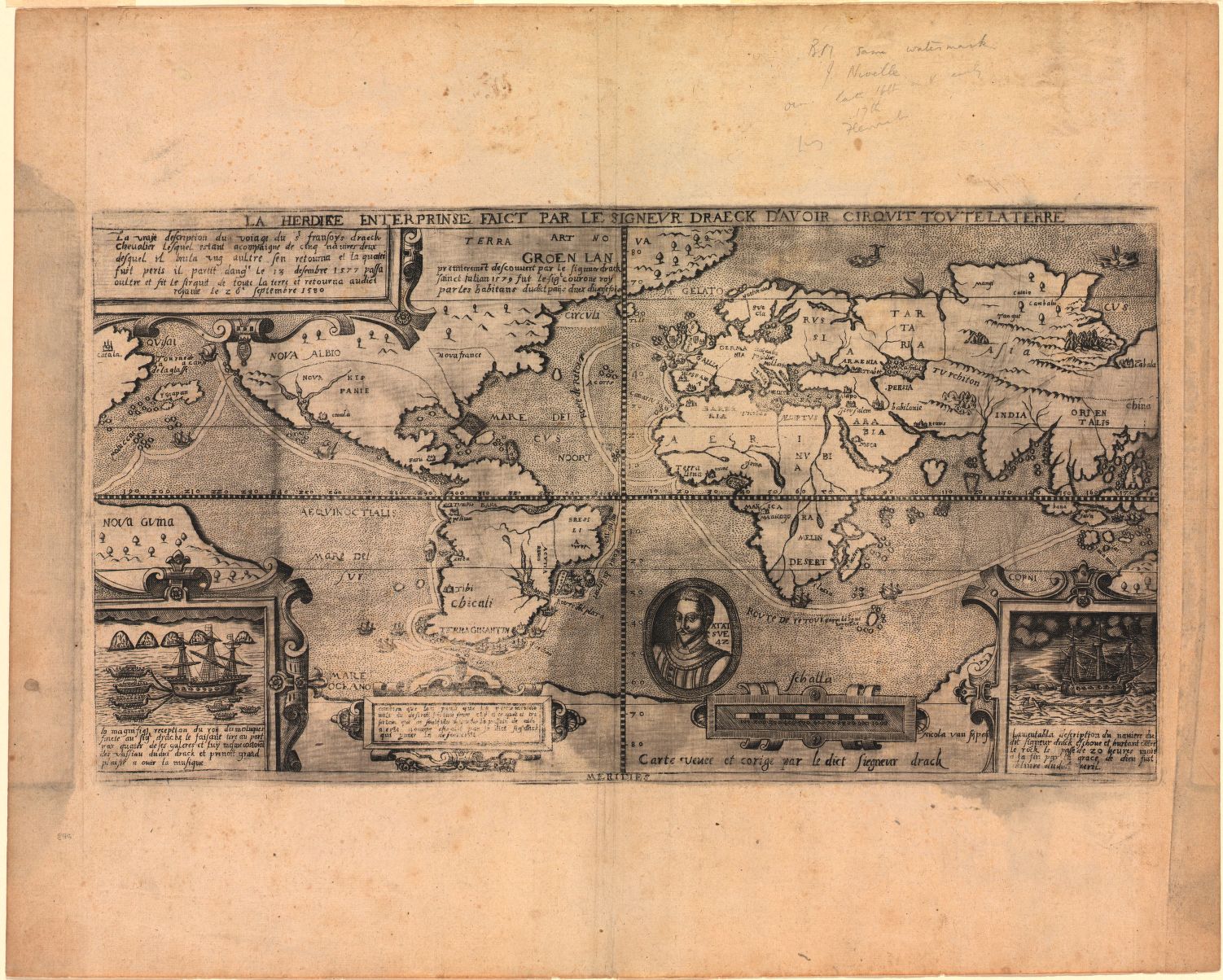
La herdike enterprinse faict par le Signeur Draeck D’Avoir cirquit toute la Terre, 1581 – https://www.loc.gov/item/2004629174/
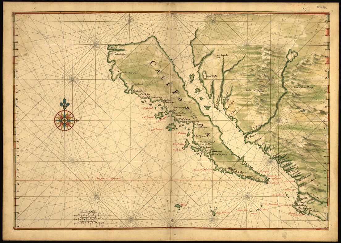
Map of California shown as an island ca. 1650 – https://www.loc.gov/item/99443375/
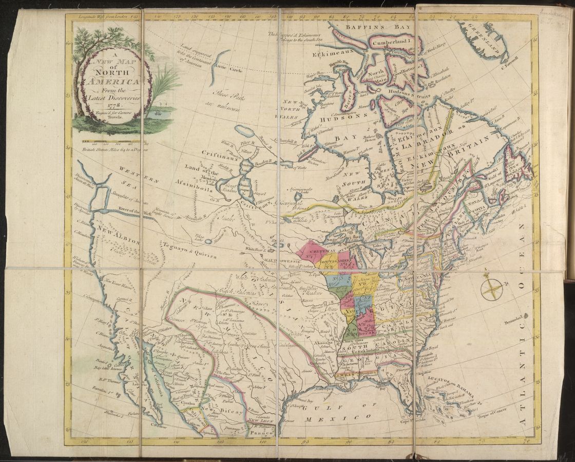
A new map of North America : from latest discoveries, 1778 – https://www.loc.gov/item/2004633177/
Ian Holt
Program Manager – Water Wells
iholt@banksinfo.com