
Have you ever wondered why there are multiple search buffers displayed in ASTM radius maps? Read this post to find out why.
When conducting ESAs on large or irregular-shaped properties, it is important that you search the entire target property (TP) in accordance with the ASTM E1527-05 standard. The standard requires (among other things) that you search specific regulatory databases outward from your TP. In addition, each database is meant to be searched to a specific distance – not all databases are searched the same.
Depending on how large or irregular-shaped your site is, searching outward from the property’s center point may not fully cover your TP as intended by the standard.
I created a short video to demonstrate how searching a property from its center point versus searching from the property boundaries can produce two very different environmental database reports. The demonstration clearly shows the additional area that is searched when conducted from the site boundaries as well as the environmental records that you could be missing if you do not perform the search correctly.
For example, USTs are meant to be searched on the entire target property and adjoining properties. In the video, you see that some areas of the target property itself are not even covered when searching from the center. All of the commercial and industrial properties to the east of the site are missed completely. By contrast, the boundary search covers these potential records of environmental concerns. This exclusion of records is due to the size and orientation of the TP. From the center point it is ¼ mile to the eastern and western property boundaries. Therefore, you are not even close to fully searching your TP and adjoining properties as the ASTM standard stipulates. Is this common you ask? Unfortunately, yes.
To get an idea of the varying search distances, I have provided a database summary page, which is where we list the required search distances for each environmental database. It is a misconception that every database gets searched to the maximum ASTM search distance of 1 mile. In reality, only a few select databases are searched outward this far, such as sites on the National Priority List (NPL) and RCRA CORRACTS.
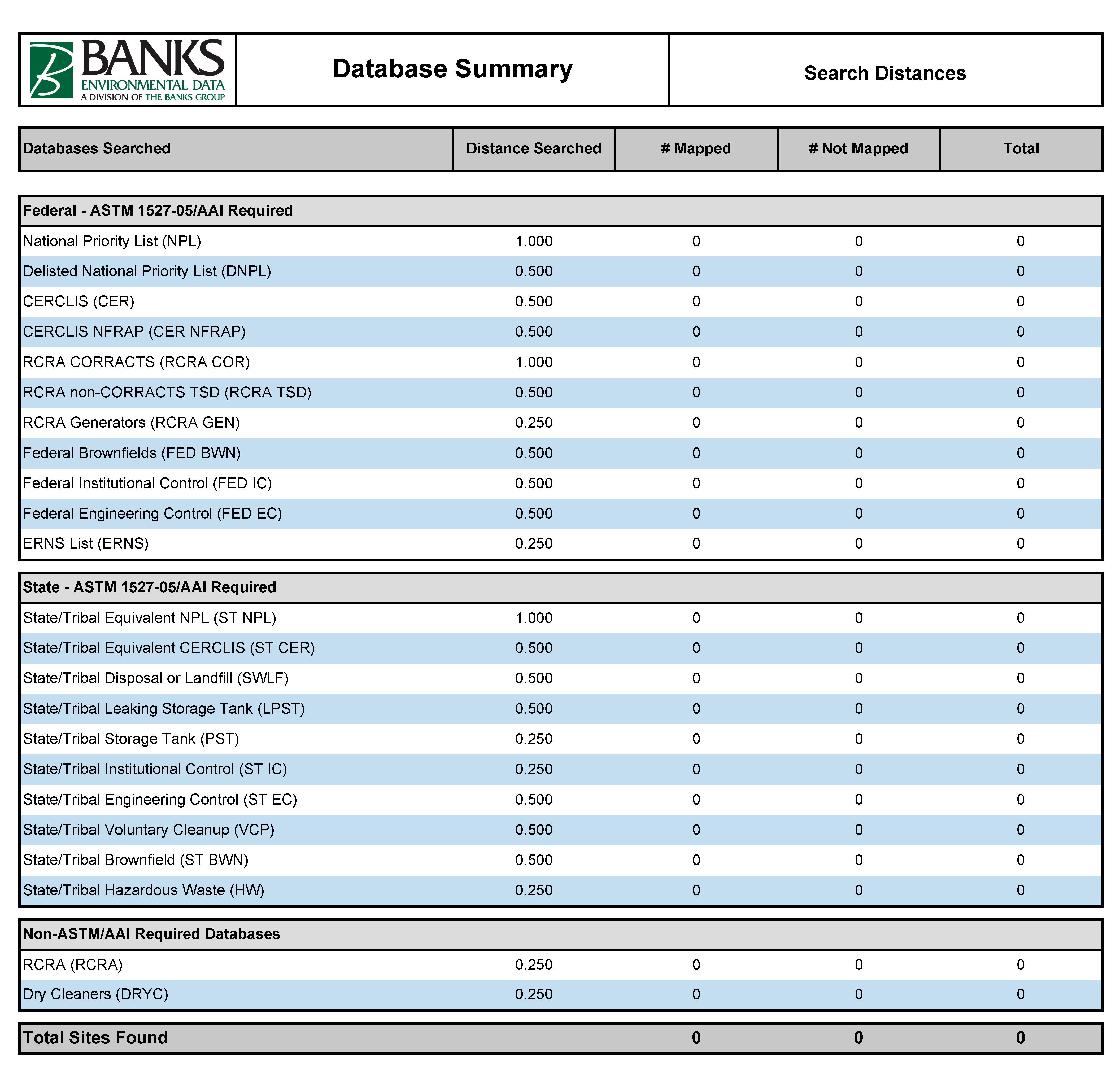
In addition, some ASTM/AAI required databases are meant to be searched to the target property only, such as state institutional/engineering controls. At Banks, we choose to search these databases to 0.25 miles (unless requested otherwise) to account for large or irregular properties, such as strip centers that share the same address. For example, imagine you are performing an environmental site assessment on a strip center that has 10 different suites with the same physical address. If you do not search from the property boundaries, it is possible that some of these “target property” records would not appear in your report. Although we take this extra cautionary measure, it is highly recommended that you consider the layout of your TP when deciding how to conduct your ESA search.
Searching your site the correct way can be the reason why you discovered a potential environmental concern and the other guy didn’t!
Until next time,
Jordan Schmidt 
Editor
jschmidt@banksinfo.com