
In previous installments of our Understanding Aerial Photography series, we covered the History of Aerial Photography, Scaling and Formatting of Aerial Imagery, and the different types of formats in which aerial imagery can be viewed. Aerial photography is used in numerous ways across many professional fields. The applications of aerial imagery will continue to grow and expand in the constantly changing world of scientific and technological advancement. In this post, we will shed some light on the wide-ranging uses of aerial photography.
Common applications
Aerial photography is used for environmental due diligence and site assessments, often as part of Phase I environmental site assessments. The designation of environmental liability, reclamation obligations, and historical site documentation are some of the other common applications of aerial photography for property analysis. Aerial imagery is widely used in various disciplines associated with land-use planning as well as building and development growth.
Aerial photography also plays an important role in cartography, geodesy, remote sensing, and many environmental studies. From vegetation growth tracking and forestry studies to storm water management and stream restoration, aerial photography has become an essential tool in helping understand the complex systems in which we live.
Lesser-known uses
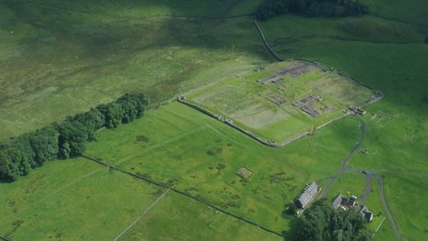
Archeology is another science that benefits from aerial photography, as a high viewpoint permits better understanding of fine details and their relationships within the wider site context. Aerial archeology has helped rewrite history and continues to do so. One recent example comes to us from Hadrian’s Wall in Warwickshire, England, where a new discovery based on aerial photography and imaging techniques is revealing a whole era of Roman history.
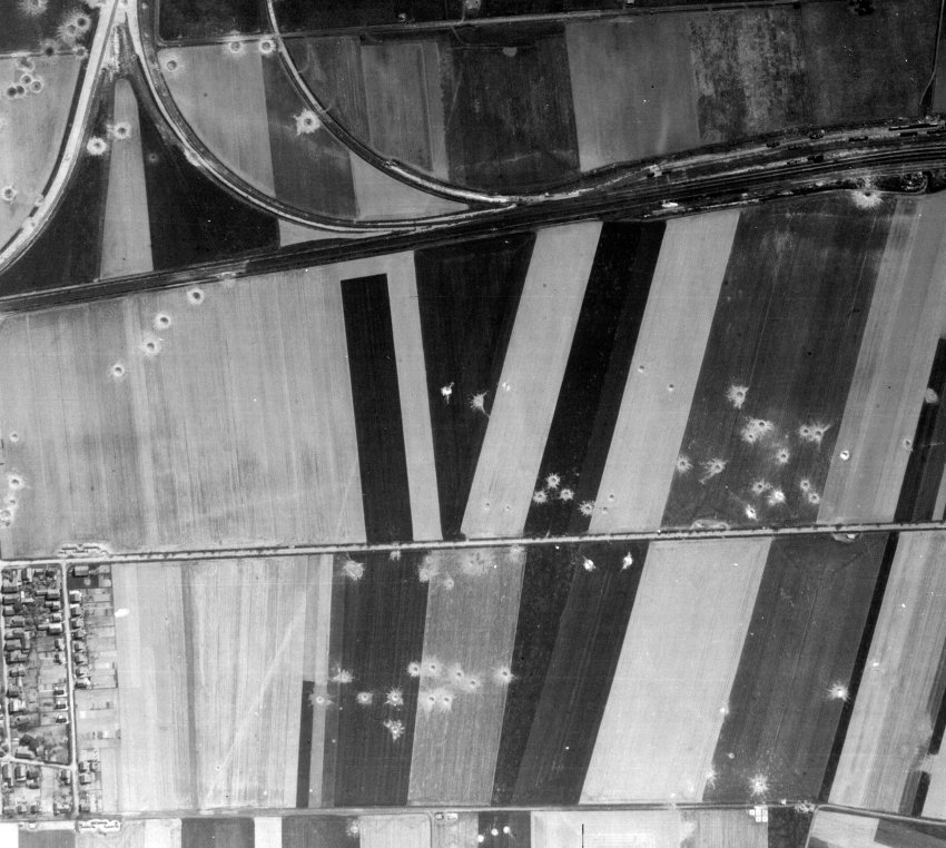
Aerial photography can also be used in unique ways for specialized purposes. One example comes from Germany, where a small German firm offers a unique service to the country’s construction industry: It uses historical British and American aerial photography from World War II airstrikes to determine the location of unexploded bombs. Thousands of tons of bombs still lie in the soil, and the duds remain dangerous.
Far-out applications of aerial photography
As the civilian drone aircraft industry continues to grow, so do the potential applications Northwest professor turns to drones in quest for Sasquatch.
Mark Gamble
Program Manager – Aerials and Historic Mapping
mgamble@banksinfo.com